Funding for Mapping Project to protect marine habitats
Since 1985 an increasing amount of the Island’s electricity has been imported through undersea cables from France which come ashore at Archirondel, St Martin and Longbeach, Grouville.
Minimising our impact and protecting the environment in which we operate is core to Jersey Electricity’s values and the Company frequently supports others who endeavour to do the same. Over the years we have backed several campaigns that help support our environment. We have supported the National Trust Coastline Campaign with extensive restorations works at Plémont as well as funding a film to mark the campaign's10th Anniversary.
More recently, Jersey Electricity has funded the Marine Biology Section (MBS) of the Societe Jersiaise to launch a Marine Mapping Project that will eventually build an interactive biological map of Jersey’s coasts and offshore reefs to help protect marine habitats.
To date the survey work on this has thrown up some astounding results, including biodiversity hotspots of national and possibly international importance, highlighting species that have not been recorded for decades or, in a couple of instances centuries.

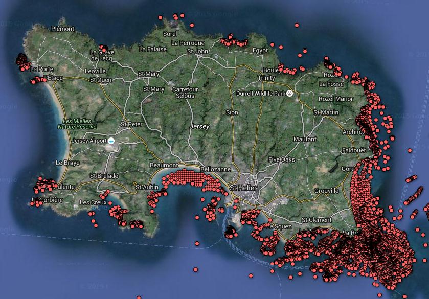
The location of intertidal habitat records from around the coast of Jersey
BACKGROUND ON THE MARINE MAPPING PROJECT
Initiated in 2014, the project is on a scale never before undertaken in the Channel Islands and will place Jersey at the forefront of scientific knowledge and understanding of its marine environment. On completion the maps will be freely available online for public use.
Benefits include: the ability to monitor and measure changes through time including the impacts of climate change, sea level rise, ocean warming, acidification and the arrival and spread of invasive species (including diseases); and the ability to enact meaningful spatial planning decisions when it comes to coastal and offshore marine use (commercial and leisure) and conservation initiatives.
Other benefits will include the ability to perform detailed ecosystem services assessments on small or large areas of seashore, to map and assess key coastal archaeological and geological features and an enhanced understanding of the diversity and distribution of species about the Island. This work also ties in with existing survey work on the offshore reefs and in the shallow marine, eventually leading to one of the most detailed biologically mapped areas in North-west Europe.
PROGRESS TO DATE
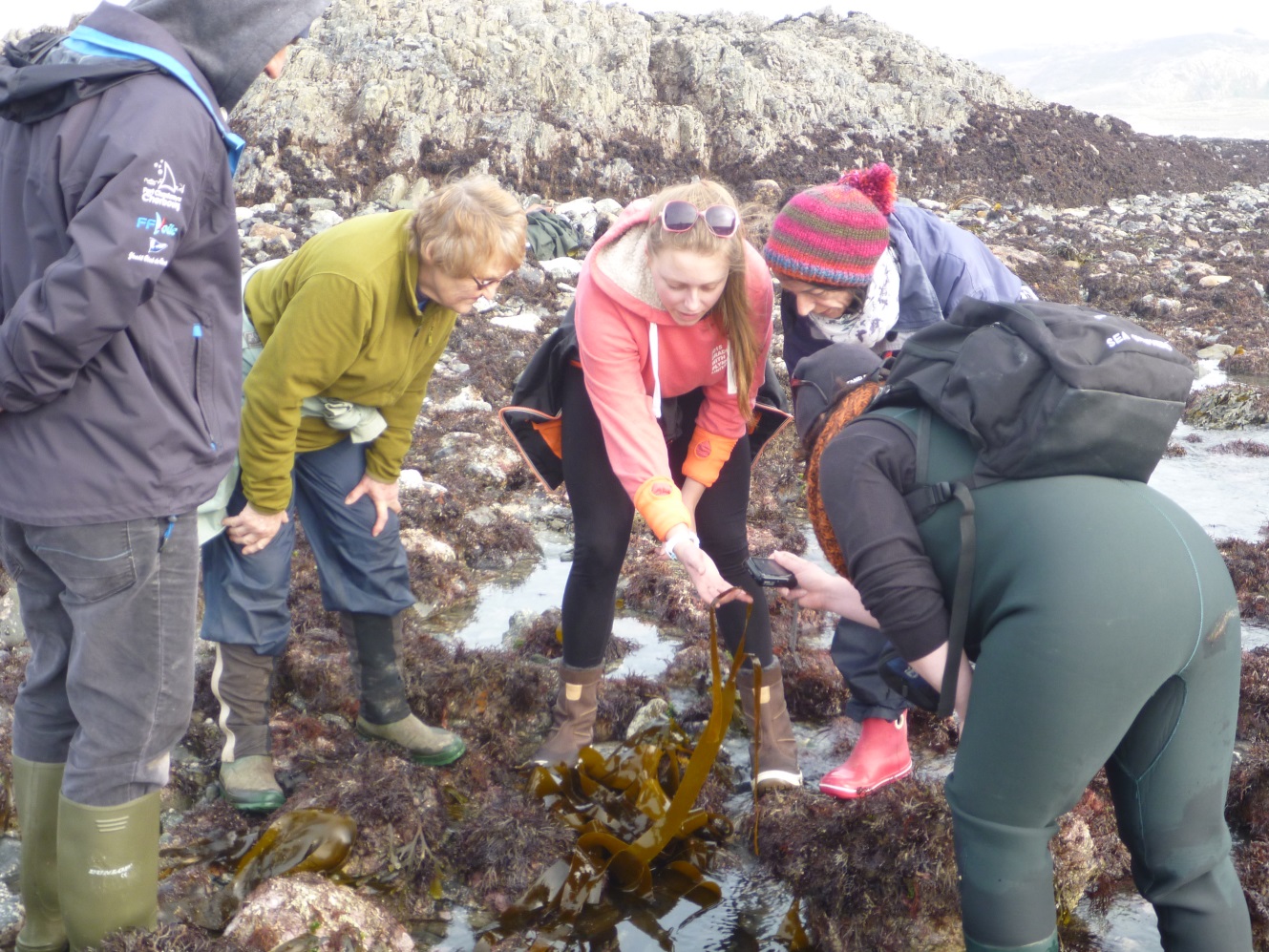
To date MBS has conducted over 100 individual seashore surveys and made over 6,000 georeferenced habitat records within Jersey’s intertidal zone. Over 12,000 species records have been made (each linked to a habitat) giving a stronger level of detail to the results. The location of the habitat data points are shown on Figure 1.
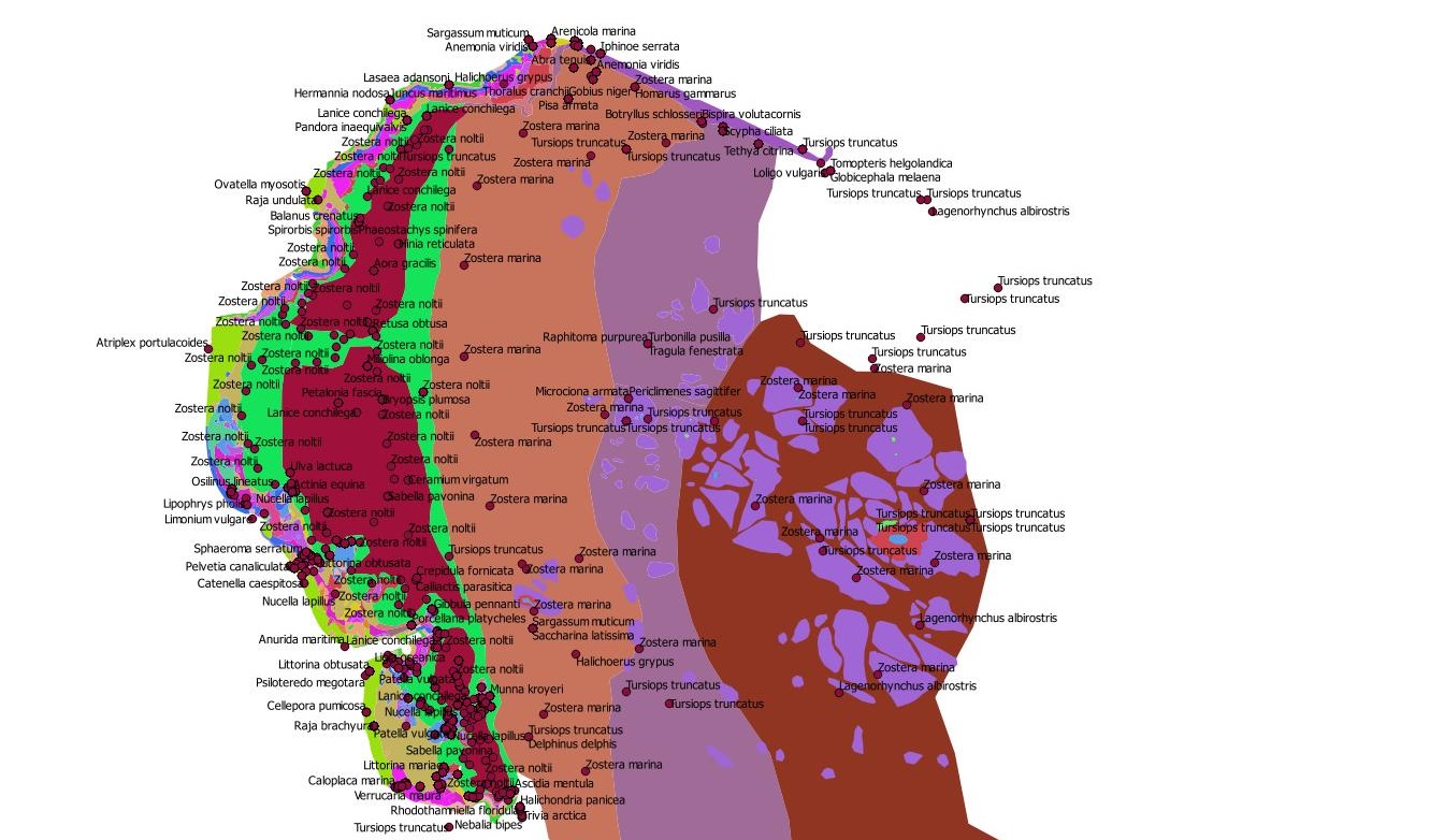
Work has mostly been focused on Jersey’s south and east coasts as this is the most geographically expansive and biological complex area of seashore in the Island. This rich area has thrown up some astounding results.
As well as recording habitats, the project team have been mapping features that are of probable historical, geological and archaeological interest (e.g. old quarries, mineral veins, shipwrecks, fishing marks, etc.).
Chairman of the Société MBS, Francis Binney, says: ‘ From this work we suspect that we have discovered some significant prehistoric structures on the south-east coast (Figure 2); we have also found two unexploded German artillery shells.
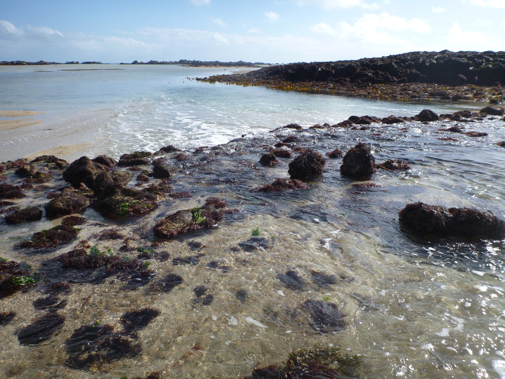
‘The process of creating a digital map started in the summer of 2015. We prioritised around St Catherine’s Bay, where Jersery Electricity is replacing its original undersea cable in 2016, as a gesture of thanks for the Company’s generous support of the project (Figure 3). A second phase of mapping will begin in the summer of 2016, once a majority of the seashore survey work has been completed.

LOOKING FORWARD
‘In 2016 we shall be focusing our attention on the north and west coasts, as well as the many small inshore rocks and reefs that are better accessed by boat. These reefs are of particular importance as their relative inaccessibility makes them an interesting comparison habitat for the areas of coastline that receive more regular human traffic. The steep profile of some parts of the coast will makes its assessment and mapping more challenging but it is expected that these areas will be surveyed by kayak, boat or aerial drones.
FUNDING
‘The project was able to get underway properly due to a generous donation by Jersey Electricity. This initial donation allowed the MBS to acquire the necessary equipment for the survey work and to begin the mapping to process at a rapid pace.
Over the summer of 2015 two further grants were sourced from the Howard Davis Farm Trust and the John Lewis Foundation, allowing work to continue apace. This has brought the project to just shy of 50% of our planned budget for full implementation and we are actively searching for funders to help bring the project to its conclusion.
Jersey Electricity has been by far our most generous backer to date and our thanks for this is immeasurable. The project could never have got underway without their support, especially as the other funding bodies have seen JE’s support as an endorsement of the project’s validity and value to Jersey.